Park City Golf Course
Plan your round at Park City Golf Course
Park City Golf Club is the city-owned municipal course in Park City, Utah, an 18-hole par 72 layout in the Thaynes Canyon neighborhood. It plays 6,622 yards from the back tees and is a local favorite with leagues, lessons and a pro shop. In winter the course is used for Nordic skiing under a city contract.
- Municipal
- 18 holes
- Par 72
Course strategy
Read the card before you play it
Walk the course
Park City Golf Course hole by hole
Hole 1
457
yds ·Middle
No notes for this hole yet.
Hole 2
145
yds ·Middle
No notes for this hole yet.
Hole 3
403
yds ·Middle
No notes for this hole yet.
Hole 4
507
yds ·Middle
No notes for this hole yet.
Hole 5
364
yds ·Middle
No notes for this hole yet.
Hole 6
333
yds ·Middle
No notes for this hole yet.
Hole 7
395
yds ·Middle
No notes for this hole yet.
Hole 8
191
yds ·Middle
No notes for this hole yet.
Hole 9
397
yds ·Middle
No notes for this hole yet.
Hole 10
310
yds ·Middle
No notes for this hole yet.
Hole 11
323
yds ·Middle
No notes for this hole yet.
Hole 12
322
yds ·Middle
No notes for this hole yet.
Hole 13
147
yds ·Middle
No notes for this hole yet.
Hole 14
395
yds ·Middle
No notes for this hole yet.
Hole 15
382
yds ·Middle
No notes for this hole yet.
Hole 16
512
yds ·Middle
No notes for this hole yet.
Hole 17
188
yds ·Middle
No notes for this hole yet.
Hole 18
495
yds ·Middle
No notes for this hole yet.
ScorecardView the full scorecard
Distances in yards
| Hole | Par | Hcp | Back | Middle | Forward |
|---|---|---|---|---|---|
| 1 | 5 | — | 486 | 457 | 435 |
| 2 | 3 | — | 185 | 145 | 105 |
| 3 | 4 | — | 413 | 403 | 330 |
| 4 | 5 | — | 521 | 507 | 453 |
| 5 | 4 | — | 369 | 364 | 337 |
| 6 | 4 | — | 351 | 333 | 292 |
| 7 | 4 | — | 404 | 395 | 320 |
| 8 | 3 | — | 215 | 191 | 148 |
| 9 | 4 | — | 416 | 397 | 375 |
| Out | 36 | 3,360 | 3,192 | 2,795 | |
| 10 | 4 | — | 320 | 310 | 300 |
| 11 | 4 | — | 335 | 323 | 284 |
| 12 | 4 | — | 342 | 322 | 305 |
| 13 | 3 | — | 171 | 147 | 115 |
| 14 | 4 | — | 426 | 395 | 304 |
| 15 | 4 | — | 395 | 382 | 358 |
| 16 | 5 | — | 527 | 512 | 461 |
| 17 | 3 | — | 220 | 188 | 156 |
| 18 | 5 | — | 526 | 495 | 480 |
| In | 36 | 3,262 | 3,074 | 2,763 | |
| Total | 72 | 6,622 | 6,266 | 5,558 |
Before you go
Everything to know on arrival
Know before you go
- Book early: online times open nine days ahead, phone times seven days ahead
- Bring a credit card to hold the reservation
- Plan to carpool, since parking is limited
- Bring your own clubs or ask the shop about rentals
- Leave outside coolers at home
Arrival & check-in
Parking at the course is limited, and the city encourages carpooling or other transportation to the course.
Practice facilities
The practice area has an eighteen-station driving range, two practice greens and a putting green.
Rentals & pro shop
Players need to bring their own clubs, though rental clubs are offered through the golf shop.
Policies
Tee times can be reserved by phone up to 7 days ahead or online up to 9 days ahead; online booking is through MemberSports and needs a customer profile and a valid credit card. Each reservation is limited to two tee times. Times before 3 p.m. are for 18 holes, and 9-hole times open after 3 p.m. (before 8 a.m. by calling the shop). Players must be at least 7 years old and non-playing spectators at least 16. Outside coolers are not allowed. Because of shorter daylight in spring and fall, the last 18-hole tee time is around 2:30 p.m.
Quick answers
Park City Golf Course at a glance
Is Park City Golf Course open to the public?
Yes. Park City Golf Course is a municipal course, open to the public.
How many holes does Park City Golf Course have, and what's the par?
Park City Golf Course has 18 holes and plays to a par of 72, from 5,558 to 6,622 yards depending on the tees.
Is there a hole-by-hole guide to Park City Golf Course?
Yes. You can see Park City Golf Course hole by hole on its interactive 3D map: fly a hole free, then unlock the rest.
What practice facilities does Park City Golf Course have?
The practice area has an eighteen-station driving range, two practice greens and a putting green.
How do you book a tee time at Park City Golf Course?
Call the course at (435) 615-5800.
Where is Park City Golf Course?
Park City Golf Course is at 1541 Thaynes Canyon Dr, Park City, UT 84060.
Info last reviewed November 13, 2026. Policies change — confirm with the course before your round.
3D course map
Park City Golf Course hole by hole, in 3D.
Fly down each hole on real 3D imagery: tilt, turn and zoom to see the landing areas, the hazards and the green before you play.
Hole 1 is open to everyone. Sign in or sign up free to see every hole.
The 3D course map is made by maps.golf. It isn’t affiliated with, sponsored by or endorsed by Park City Golf Course.
More golf in Utah
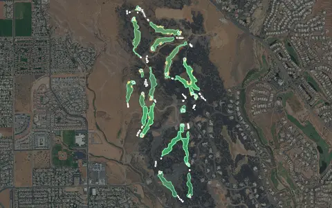
Aerial imagery: USDA NAIP. Some hole outlines © OpenStreetMap contributors.
All Utah golf courses →- #9 of 11 · Longest golf courses in Utah by yardage
- #967 of 1677 · Longest golf courses by yardage
Want this for your own course?
The map below is a real maps.golf embed — the same interactive 3D map a visitor sees dropped directly into Park City Golf Course's own website.