Sault Sainte Marie Country Club
Plan your round at Sault Sainte Marie Country Club
Sault Sainte Marie Country Club is an 18-hole, par 71 course on the St. Marys River, with views of passing freighters from spots including the 17th green. It ran as nine holes for most of its history before Michigan architect Jerry Matthews expanded it to 18 in the mid-1980s, adding ponds. The blue tees play 6,333 yards (rating 71.5, slope 131). The clubhouse has a full-menu restaurant, the GrillRoom 1901.
- Public
- 18 holes
- Par 71
- Designed by Jerry Matthews
- Opened 1901
Course strategy
Read the card before you play it
Walk the course
Sault Sainte Marie Country Club hole by hole
Hole 1
460
yds ·Gold
No notes for this hole yet.
Hole 2
313
yds ·Gold
No notes for this hole yet.
Hole 3
133
yds ·Gold
No notes for this hole yet.
Hole 4
410
yds ·Gold
No notes for this hole yet.
Hole 5
372
yds ·Gold
No notes for this hole yet.
Hole 6
260
yds ·Gold
No notes for this hole yet.
Hole 7
282
yds ·Gold
No notes for this hole yet.
Hole 8
100
yds ·Gold
No notes for this hole yet.
Hole 9
261
yds ·Gold
No notes for this hole yet.
Hole 10
340
yds ·Gold
No notes for this hole yet.
Hole 11
310
yds ·Gold
No notes for this hole yet.
Hole 12
269
yds ·Gold
No notes for this hole yet.
Hole 13
277
yds ·Gold
No notes for this hole yet.
Hole 14
267
yds ·Gold
No notes for this hole yet.
Hole 15
151
yds ·Gold
No notes for this hole yet.
Hole 16
298
yds ·Gold
No notes for this hole yet.
Hole 17
460
yds ·Gold
No notes for this hole yet.
Hole 18
128
yds ·Gold
No notes for this hole yet.
ScorecardView the full scorecard
Distances in yards
| Hole | Par | Hcp | Blue | White | Gold | Red |
|---|---|---|---|---|---|---|
| 1 | 5 | 15 | 491 | 479 | 460 | 368 |
| 2 | 4 | 5 | 415 | 386 | 313 | 307 |
| 3 | 3 | 9 | 167 | 148 | 133 | 101 |
| 4 | 5 | 13 | 482 | 466 | 410 | 403 |
| 5 | 4 | 1 | 430 | 388 | 372 | 280 |
| 6 | 4 | 11 | 288 | 267 | 260 | 251 |
| 7 | 4 | 7 | 386 | 365 | 282 | 277 |
| 8 | 3 | 17 | 152 | 117 | 100 | 92 |
| 9 | 4 | 3 | 382 | 358 | 261 | 257 |
| Out | 36 | 3,193 | 2,974 | 2,591 | 2,336 | |
| 10 | 4 | 2 | 380 | 357 | 340 | 316 |
| 11 | 4 | 12 | 351 | 342 | 310 | 256 |
| 12 | 4 | 6 | 399 | 377 | 269 | 264 |
| 13 | 4 | 14 | 347 | 335 | 277 | 273 |
| 14 | 4 | 16 | 343 | 304 | 267 | 219 |
| 15 | 3 | 10 | 207 | 187 | 151 | 134 |
| 16 | 4 | 8 | 404 | 367 | 298 | 290 |
| 17 | 5 | 4 | 543 | 530 | 460 | 413 |
| 18 | 3 | 18 | 166 | 146 | 128 | 118 |
| In | 35 | 3,140 | 2,945 | 2,500 | 2,283 | |
| Total | 71 | 6,333 | 5,919 | 5,091 | 4,619 | |
| Rating / Slope | 71.5 / 131 | 69.2 / 128 | 65.6 / 117 | 62.4 / 112 | ||
| Women's rating / slope | — | — | — | 67.2 / 116 | ||
Scorecard data: OpenGolfAPI, © OpenStreetMap contributors (ODbL)
Before you go
Everything to know on arrival
Food & drink
The clubhouse restaurant, GrillRoom 1901, serves a full menu.
Policies
The season runs roughly mid-April to mid-October. Shirts must be worn at all times.
Quick answers
Sault Sainte Marie Country Club at a glance
Is Sault Sainte Marie Country Club open to the public?
Yes. Sault Sainte Marie Country Club is a public course.
How many holes does Sault Sainte Marie Country Club have, and what's the par?
Sault Sainte Marie Country Club has 18 holes and plays to a par of 71, from 4,619 to 6,333 yards depending on the tees.
Is there a hole-by-hole guide to Sault Sainte Marie Country Club?
Yes. You can see Sault Sainte Marie Country Club hole by hole on its interactive 3D map: fly a hole free, then unlock the rest.
Who designed Sault Sainte Marie Country Club?
Sault Sainte Marie Country Club was designed by Jerry Matthews and opened in 1901.
What food and drink does Sault Sainte Marie Country Club have?
The clubhouse restaurant, GrillRoom 1901, serves a full menu.
How do you book a tee time at Sault Sainte Marie Country Club?
Call the course at (906) 632-7812.
Where is Sault Sainte Marie Country Club?
Sault Sainte Marie Country Club is at Hudson Drive, Sault Ste. Marie, MI 49783.
Info last reviewed November 13, 2026. Policies change — confirm with the course before your round.
3D course map
Sault Sainte Marie Country Club hole by hole, in 3D.
Fly down each hole on real 3D imagery: tilt, turn and zoom to see the landing areas, the hazards and the green before you play.
Hole 1 is open to everyone. Sign in or sign up free to see every hole.
The 3D course map is made by maps.golf. It isn’t affiliated with, sponsored by or endorsed by Sault Sainte Marie Country Club.
More golf in Michigan
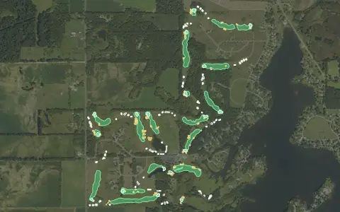
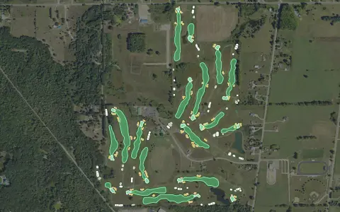
Aerial imagery: USDA NAIP. Some hole outlines © OpenStreetMap contributors.
All Michigan golf courses →- #62 of 152 · Hardest golf courses in Michigan by slope rating
- #111 of 168 · Longest golf courses in Michigan by yardage
- #697 of 1529 · Hardest golf courses by slope rating
- #1294 of 1677 · Longest golf courses by yardage
Want this for your own course?
The map below is a real maps.golf embed — the same interactive 3D map a visitor sees dropped directly into Sault Sainte Marie Country Club's own website.