El Prado Golf Courses – Chino Creek
Plan your round at El Prado Golf Courses – Chino Creek
Chino Creek is one of two 18-hole courses at El Prado Golf Courses in Chino, a public facility. It is a par 72 stretching 6,858 yards from the blue tees (rating 72.5, slope 126), with six par 4s over 390 yards and four par 5s, two of which long hitters may reach in two. Creeks or water hazards come into play on seven holes.
- Public
- 18 holes
- Par 72
Course strategy
Read the card before you play it
Walk the course
El Prado Golf Courses – Chino Creek hole by hole
Hole 1
364
yds ·White
No notes for this hole yet.
Hole 2
339
yds ·White
No notes for this hole yet.
Hole 3
389
yds ·White
No notes for this hole yet.
Hole 4
144
yds ·White
No notes for this hole yet.
Hole 5
517
yds ·White
No notes for this hole yet.
Hole 6
358
yds ·White
No notes for this hole yet.
Hole 7
142
yds ·White
No notes for this hole yet.
Hole 8
399
yds ·White
No notes for this hole yet.
Hole 9
504
yds ·White
No notes for this hole yet.
Hole 10
368
yds ·White
No notes for this hole yet.
Hole 11
350
yds ·White
No notes for this hole yet.
Hole 12
384
yds ·White
No notes for this hole yet.
Hole 13
506
yds ·White
No notes for this hole yet.
Hole 14
150
yds ·White
No notes for this hole yet.
Hole 15
406
yds ·White
No notes for this hole yet.
Hole 16
146
yds ·White
No notes for this hole yet.
Hole 17
442
yds ·White
No notes for this hole yet.
Hole 18
404
yds ·White
No notes for this hole yet.
ScorecardView the full scorecard
Distances in yards
| Hole | Par | Hcp | Blue | White | Red |
|---|---|---|---|---|---|
| 1 | 4 | 7 | 384 | 364 | 306 |
| 2 | 4 | 11 | 377 | 339 | 306 |
| 3 | 4 | 3 | 399 | 389 | 341 |
| 4 | 3 | 17 | 178 | 144 | 118 |
| 5 | 5 | 5 | 552 | 517 | 450 |
| 6 | 4 | 15 | 371 | 358 | 313 |
| 7 | 3 | 9 | 180 | 142 | 118 |
| 8 | 4 | 1 | 429 | 399 | 335 |
| 9 | 5 | 13 | 555 | 504 | 460 |
| Out | 36 | 3,425 | 3,156 | 2,747 | |
| 10 | 4 | 4 | 385 | 368 | 321 |
| 11 | 4 | 8 | 398 | 350 | 310 |
| 12 | 4 | 12 | 401 | 384 | 333 |
| 13 | 5 | 14 | 520 | 506 | 458 |
| 14 | 3 | 16 | 189 | 150 | 124 |
| 15 | 4 | 2 | 413 | 406 | 360 |
| 16 | 3 | 18 | 175 | 146 | 121 |
| 17 | 5 | 10 | 512 | 442 | 409 |
| 18 | 4 | 6 | 440 | 404 | 401 |
| In | 36 | 3,433 | 3,156 | 2,837 | |
| Total | 72 | 6,858 | 6,312 | 5,584 | |
| Rating / Slope | 72.5 / 126 | 70.2 / 122 | 67.0 / 112 | ||
Before you go
Everything to know on arrival
Know before you go
- Book through the tee times page and check course status before you drive out
- Cancel before 5 pm the day before to avoid a charge
- Keep carts on the paths and away from greens and tees
- No outside alcohol, coolers or ice chests
- Expect water on seven holes
Dress code
Casual attire is welcome, but clothing should be reasonable and appropriate.
Carts & walking
Carts must stay on the designated paths, off greens and tees, and be returned to the designated cart area. Take care on the narrow bridges and report any damage to the pro shop right away.
Practice facilities
An all-grass, 1.5-acre driving range with marked distances and targets is open from sunrise to 5:00 pm daily, with hours changing by season and weather. No reservation is needed, and lessons are offered.
Food & drink
The Fairway Cafe serves golfers at the property, and banquets and special events are hosted on site.
Policies
Cancel before 5 pm the day before your tee time to avoid a charge; same-day cancellations and no-shows are charged in full. Outside alcohol, ice chests and coolers are not allowed on the course.
Quick answers
El Prado Golf Courses – Chino Creek at a glance
Is El Prado Golf Courses – Chino Creek open to the public?
Yes. El Prado Golf Courses – Chino Creek is a public course.
How many holes does El Prado Golf Courses – Chino Creek have, and what's the par?
El Prado Golf Courses – Chino Creek has 18 holes and plays to a par of 72, from 5,584 to 6,858 yards depending on the tees.
Is there a hole-by-hole guide to El Prado Golf Courses – Chino Creek?
Yes. You can see El Prado Golf Courses – Chino Creek hole by hole on its interactive 3D map: fly a hole free, then unlock the rest.
What's the dress code at El Prado Golf Courses – Chino Creek?
Casual attire is welcome, but clothing should be reasonable and appropriate.
What are the cart and walking rules at El Prado Golf Courses – Chino Creek?
Carts must stay on the designated paths, off greens and tees, and be returned to the designated cart area. Take care on the narrow bridges and report any damage to the pro shop right away.
What practice facilities does El Prado Golf Courses – Chino Creek have?
An all-grass, 1.5-acre driving range with marked distances and targets is open from sunrise to 5:00 pm daily, with hours changing by season and weather. No reservation is needed, and lessons are offered.
What food and drink does El Prado Golf Courses – Chino Creek have?
The Fairway Cafe serves golfers at the property, and banquets and special events are hosted on site.
How do you book a tee time at El Prado Golf Courses – Chino Creek?
Call the course at (909) 597-1753.
Where is El Prado Golf Courses – Chino Creek?
El Prado Golf Courses – Chino Creek is at 6555 Pine Ave, Chino, CA 91708.
Info last reviewed November 13, 2026. Policies change — confirm with the course before your round.
3D course map
El Prado Golf Courses – Chino Creek hole by hole, in 3D.
Fly down each hole on real 3D imagery: tilt, turn and zoom to see the landing areas, the hazards and the green before you play.
Hole 1 is open to everyone. Sign in or sign up free to see every hole.
The 3D course map is made by maps.golf. It isn’t affiliated with, sponsored by or endorsed by El Prado Golf Courses – Chino Creek.
More golf in California
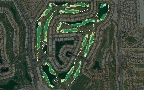
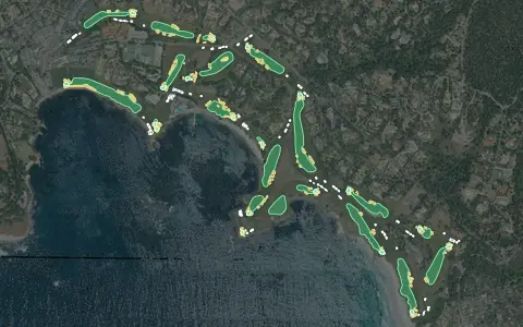
Aerial imagery: USDA NAIP. Some hole outlines © OpenStreetMap contributors.
All California golf courses →- #62 of 99 · Hardest golf courses in California by slope rating
- #34 of 107 · Longest golf courses in California by yardage
- #979 of 1529 · Hardest golf courses by slope rating
- #585 of 1677 · Longest golf courses by yardage
Want this for your own course?
The map below is a real maps.golf embed — the same interactive 3D map a visitor sees dropped directly into El Prado Golf Courses – Chino Creek's own website.